Sandwell Local Plan - Policies Map Modifications
SANDWELL LOCAL PLAN – Policies Map Modifications
Sandwell Local Plan Policies – Modifications
1Introduction
Examination hearing sessions for the Sandwell Local Plan were held between 15th July 2025 and 3rd October 2025. Alongside the Main Modifications and the Council’s Additional Modifications a number of modifications are proposed to be made to the Plan’s Policies Map when the plan is adopted and these changes are set out in this document.[I1]
2The table of Modifications
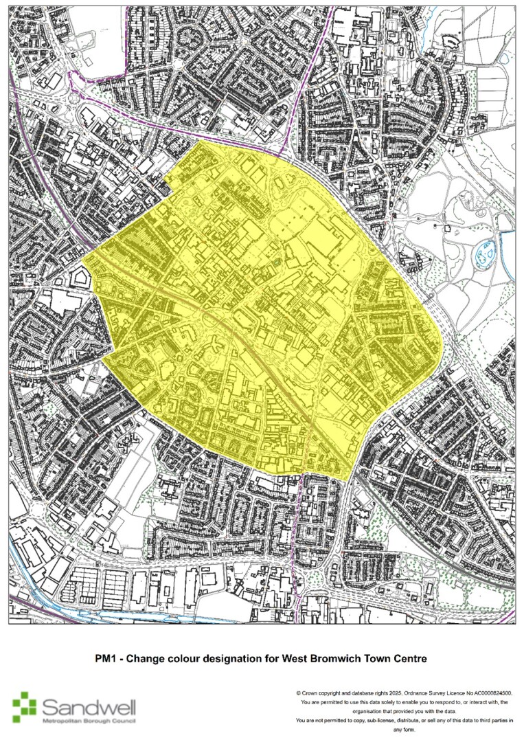
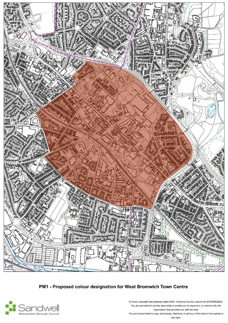
PM1
Page / paragraph / policy reference
SCE1
Proposed change
Change colour designation for West Brom Town Centre
Reason
Update
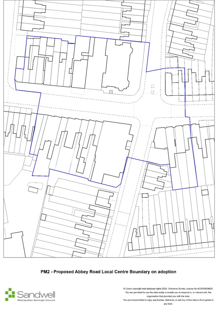
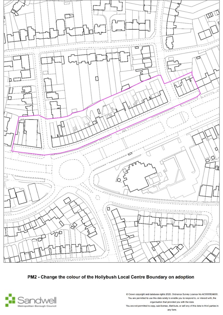
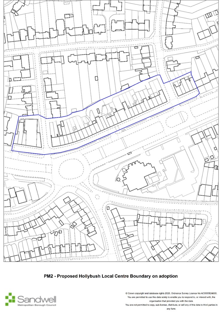
PM2
Page / paragraph / policy reference
SCE1
Proposed change
Table 10. New Local Centres x 2. On adoption change to Local Centres (i.e. delete reference to “new”). Update the rest of the plan and policies map for consistency.
Reason
Update

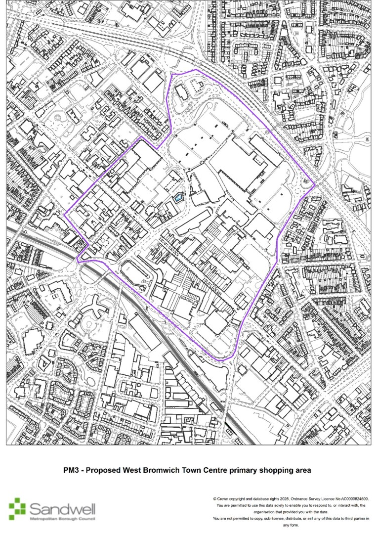
PM3
Page / paragraph / policy reference
SWB1
Proposed change
Check the pdf and interactive versions of the policies map for accuracy and consistency in respect of West Brom centre retail core / primary shopping area.
Reason
Update
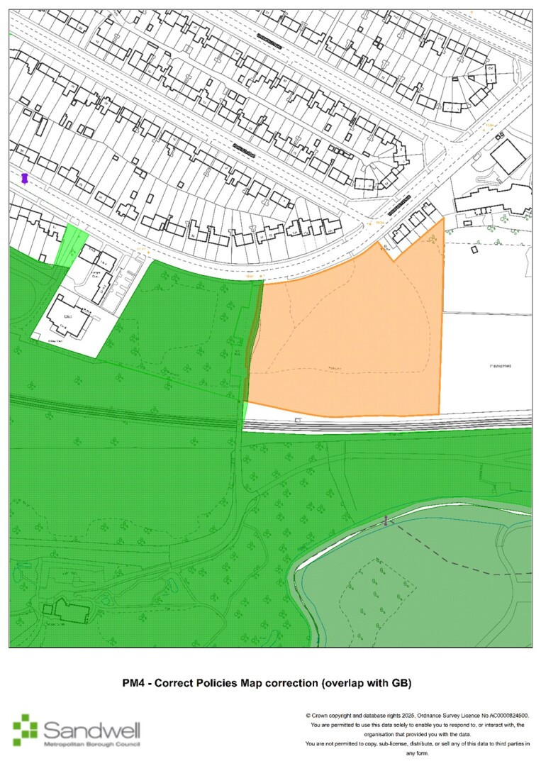
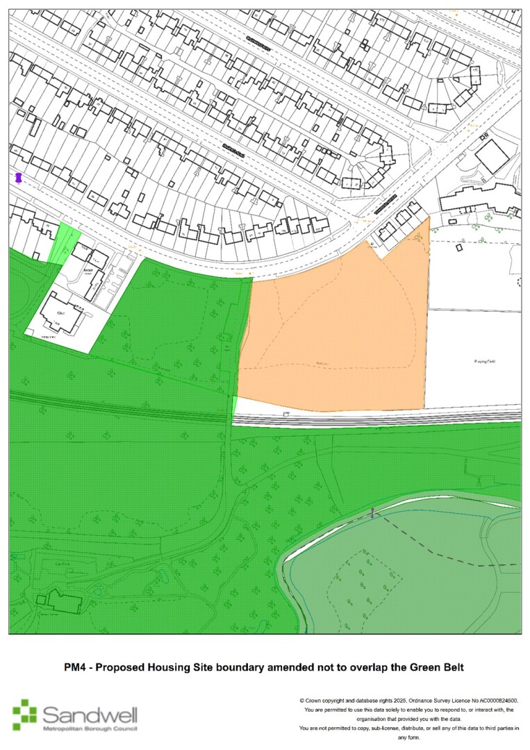
PM4
Page / paragraph / policy reference
Proposed change
Correct Policies Map correction for land off Tanhouse Avenue (SH43) (overlap with GB)
Reason
Correction
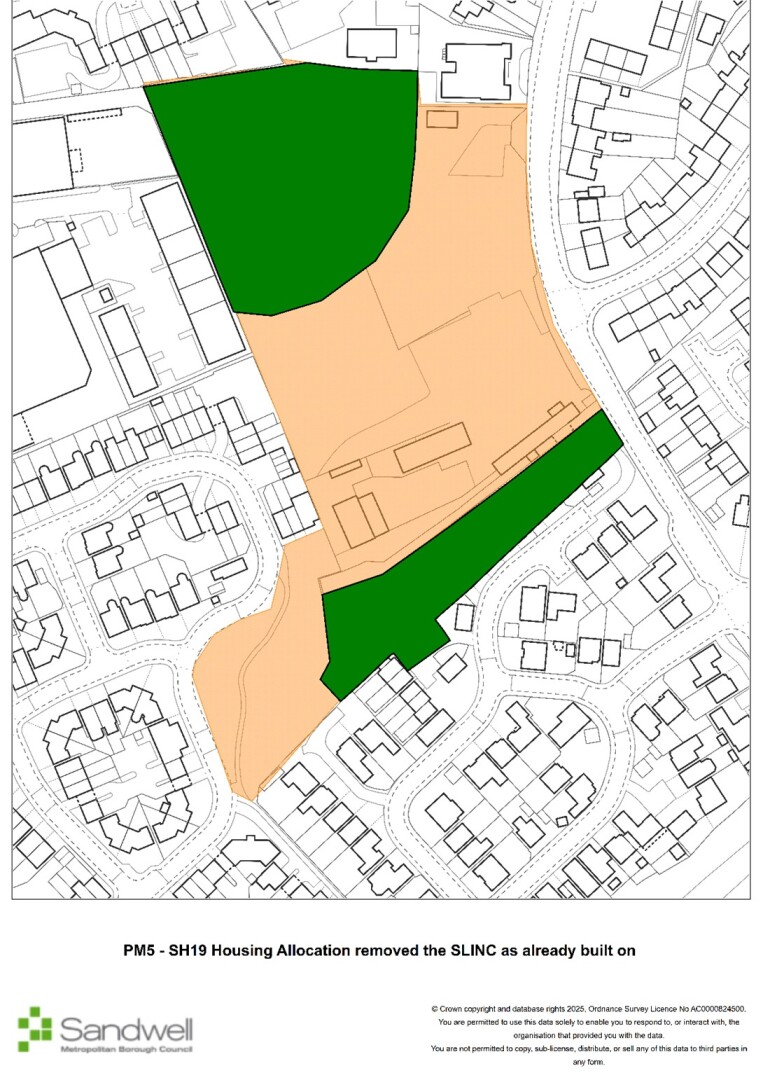
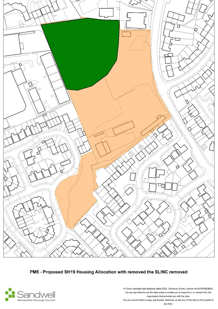
PM5
Page / paragraph / policy reference
Site allocation SH19
Proposed change
Horseley Heath etc
Update Policies Map to remove SLINC already de-allocated and built on.
Reason
Update
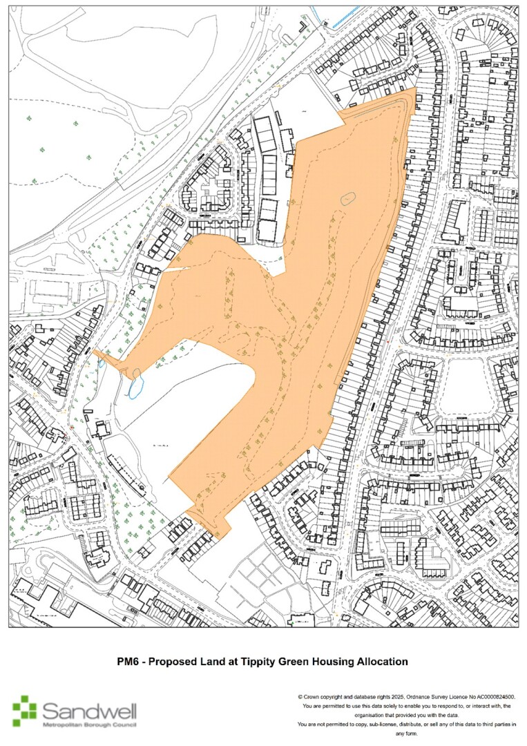
PM6
Page / paragraph / policy reference
Site allocation
Proposed change
Rowley Regis Golf Course – include on policies map
Reason
Update
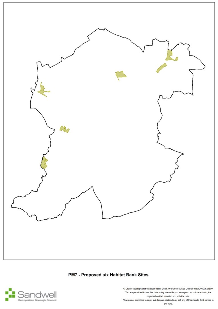
PM7
Page / paragraph / policy reference
Habitat bank sites
Proposed change
Put six habitat bank sites on the Policies Map
Reason
Clarification
PM8
Page / paragraph / policy reference
Policy SMI2.3
Proposed change
Define Consideration Zones” in the Glossary and show on Policies Map
Reason
Clarification
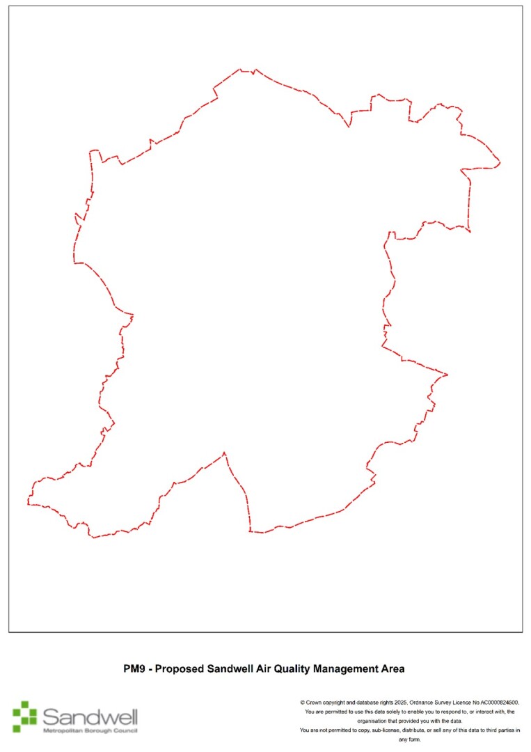
PM9
Page / paragraph / policy reference
SHW3
Proposed change
Make the AQMA a layer on the Policies Map
Reason
Clarification
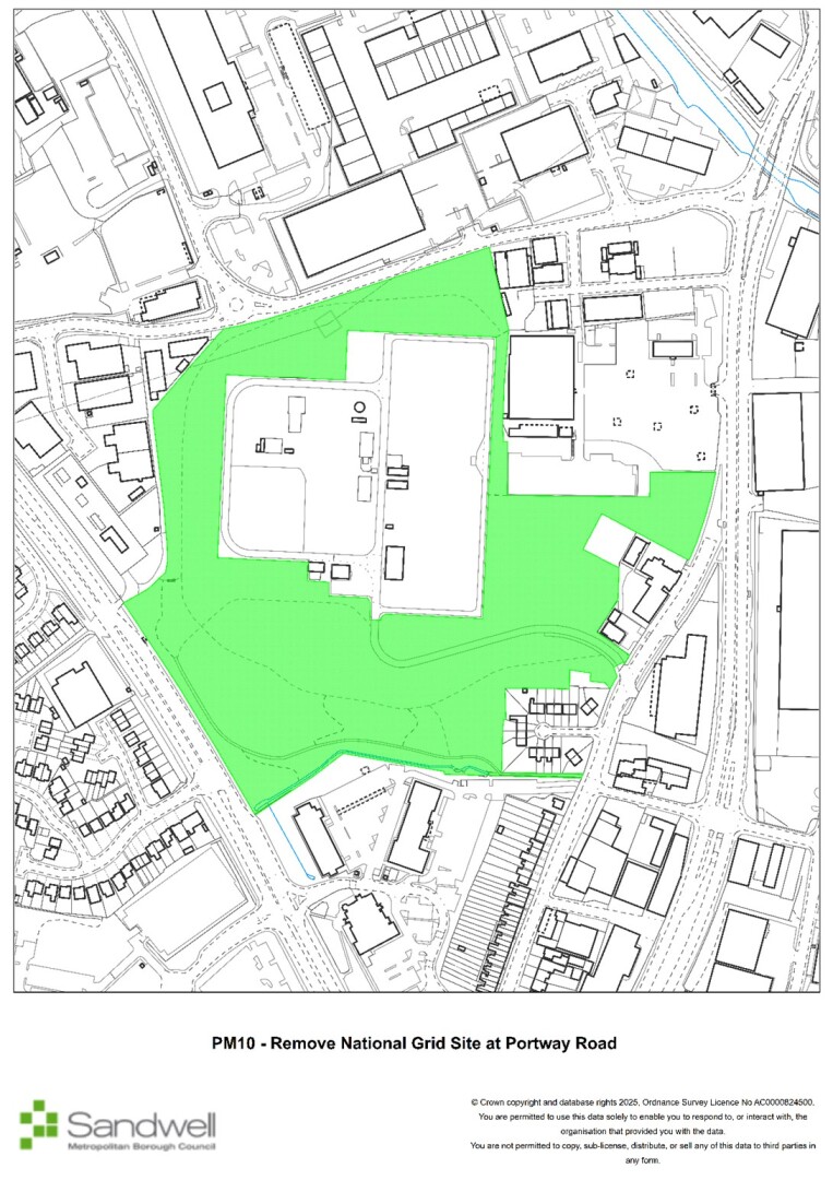
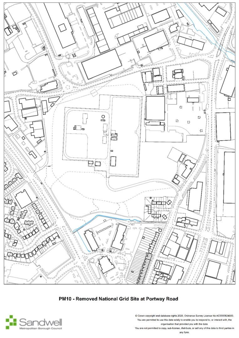
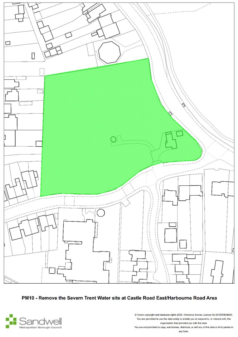
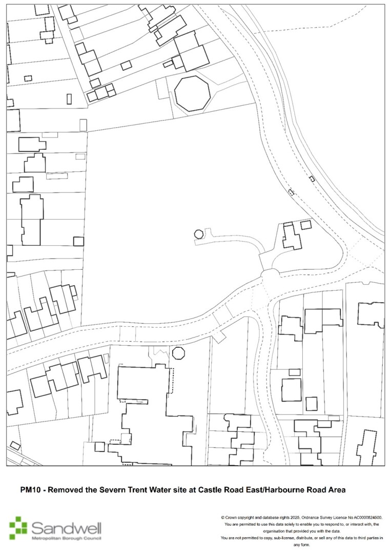
PM10
Page / paragraph / policy reference
SHW4
Proposed change
Remove the Severn Trent Water site at Castle Road East/Harbourne Road and National Grid Site at Portway Road from the open space layer
Reason
Factual correction - sites are not publicly accessible open spaces
PM11
Page / paragraph / policy reference
Change Key labels on Policies Map and Figs 6, 8, 9, 12 and 13
Proposed change
Delete reference Retail Core from Bearwood, Cape Hill, Cradley Heath, Wednesbury, West Bromwich town centres maps key. Refer to Primary Shopping Area)
Reason
Correction
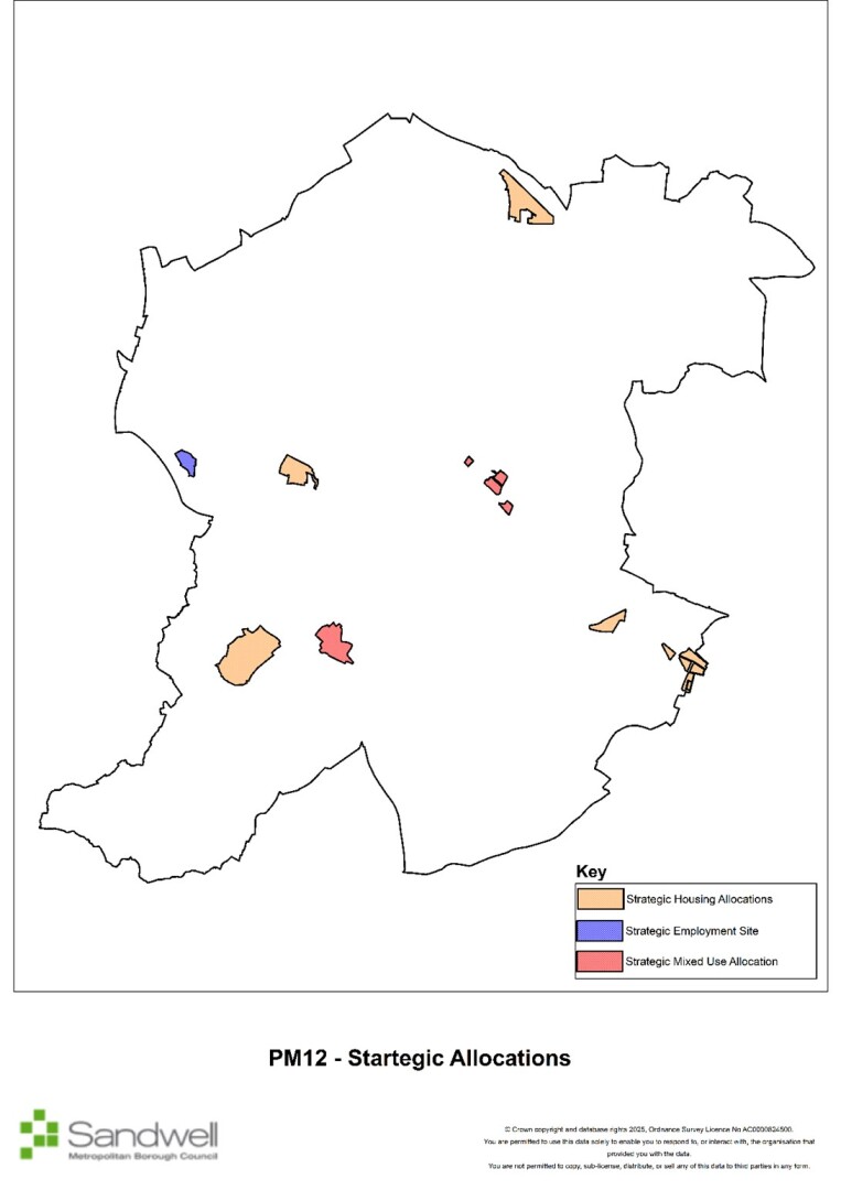
PM12
Page / paragraph / policy reference
Strategic site allocations
Proposed change
Include strategic site allocations as change to Policies Map
Reason
Clarification
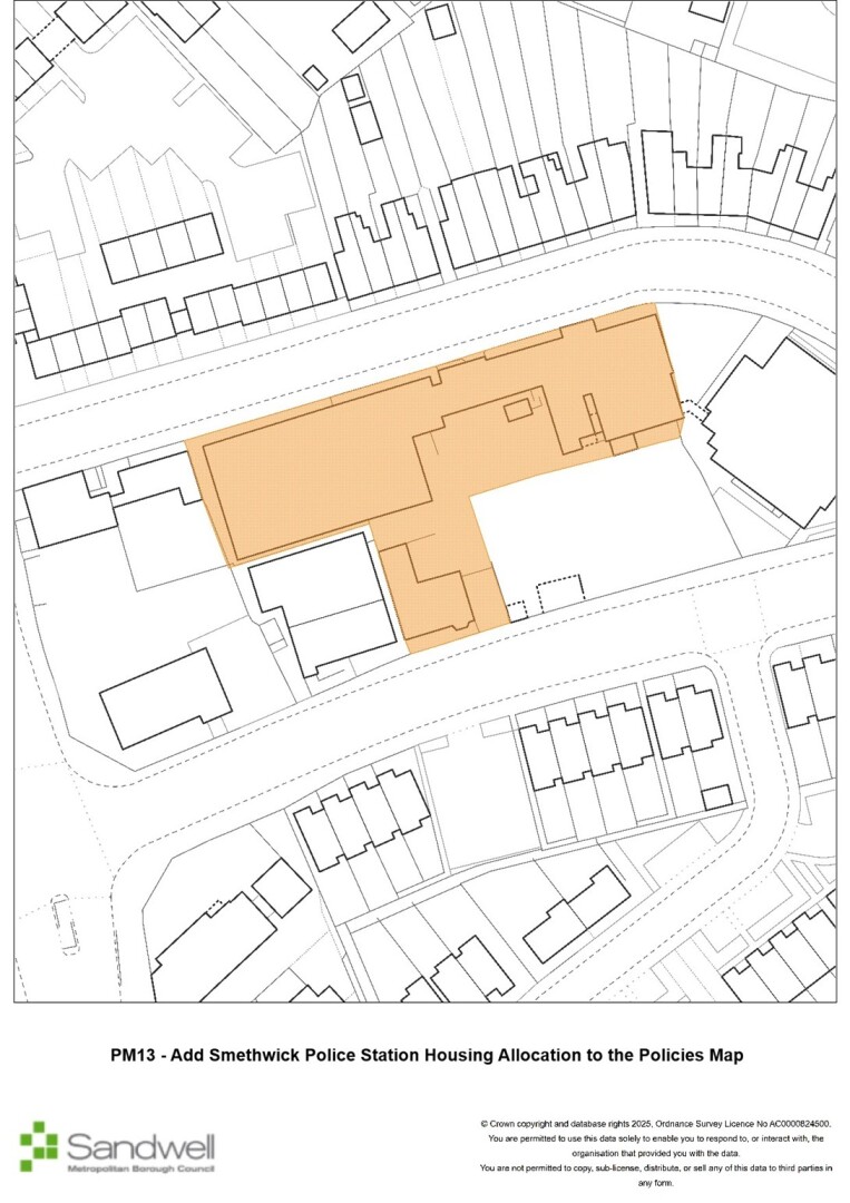
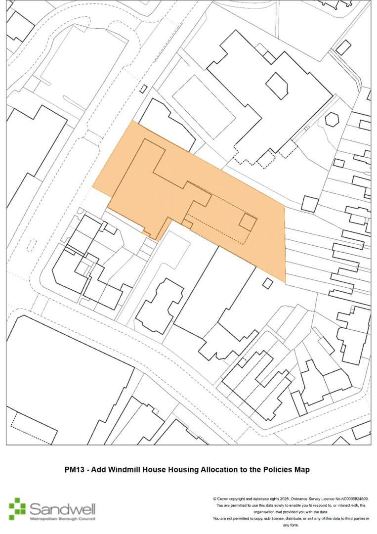
PM13
Page / paragraph / policy reference
Housing allocations
Proposed change
Add Smethwick Police Station and Windmill House housing allocations to the interactive Policies Map
Reason
Correction - sites missing from the submission Policies Map, but on the version submitted to Cabinet
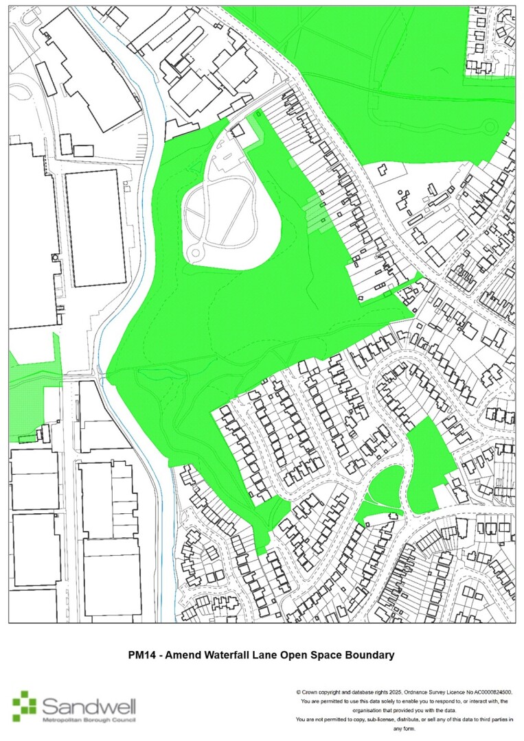
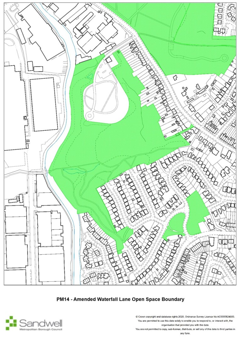
PM14
Page / paragraph / policy reference
Interactive Policies Map
Proposed change
Amend the eastern boundary of the Waterfall Lane open space designation in Rowley Regis to remove around ten residential gardens from the designation on the open space layer.
Reason
Factual correction - sites are not publicly accessible open spaces
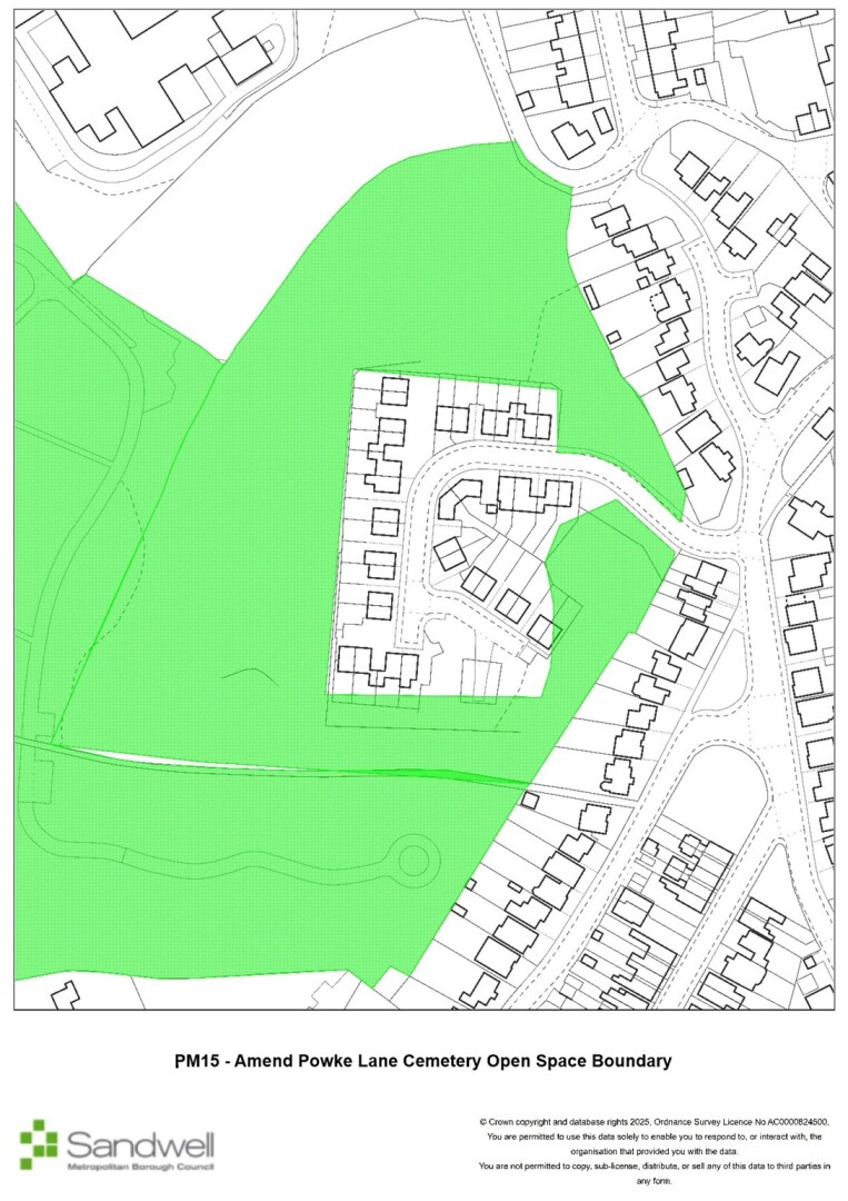
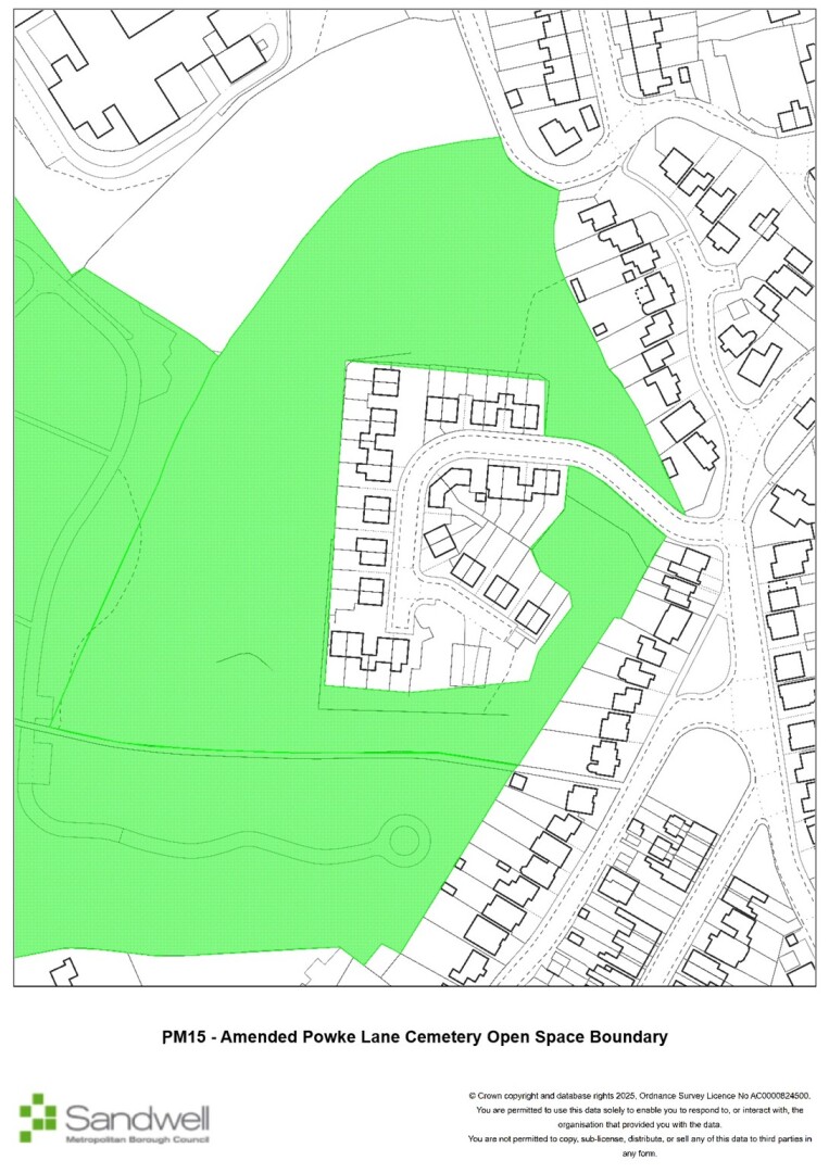
PM15
Page / paragraph / policy reference
Interactive Policies Map
Proposed change
Amend the boundary of the Powke Lane Cemetery open space designation in Rowley Regis to remove areas of residential gardens from the designation on the open space layer.
Reason
Factual correction - sites are not publicly accessible open spaces
[I1]I cannot specifically recommend main mods to the policies map, hence the need to keep these modifications separate from the Main Mods. The EiP is the whole examination process, not just the hearing sessions. Suggest it is reworded.