Sandwell Local Plan – Plan Diagram and Maps Modifications
Ended on the 30th March 2026
Plan Diagram and Maps Modifications
PM11
Page / paragraph / policy reference
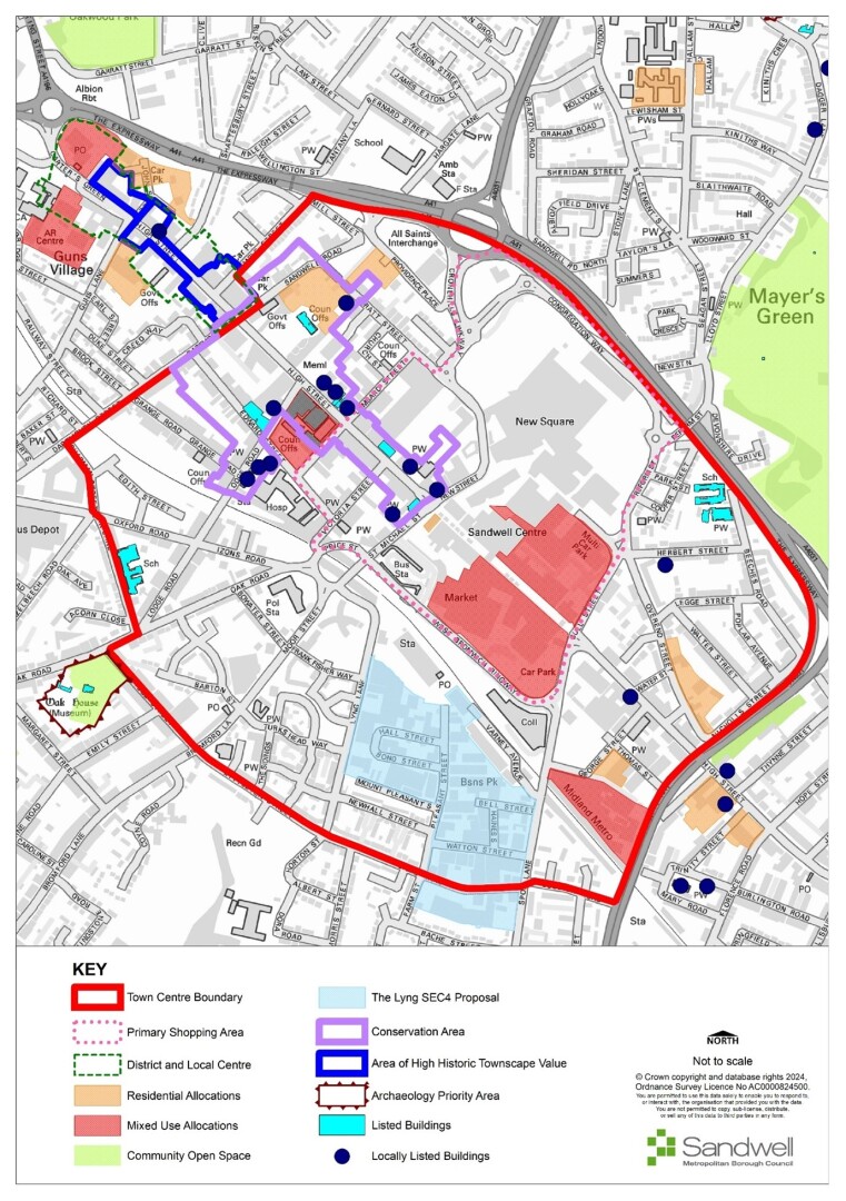
Change Key labels on Policies Map and Figs 6, 8, 9, 12 and 13
Proposed change
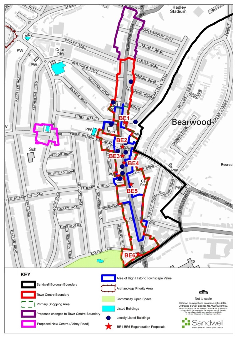
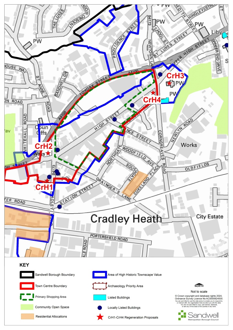
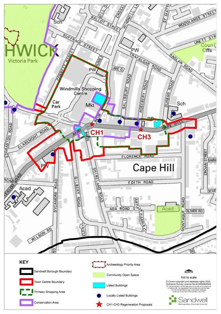
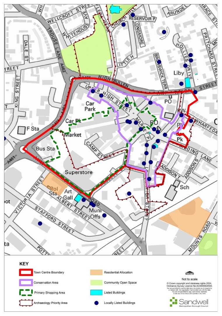
Delete reference Retail Core from Bearwood, Cape Hill, Cradley Heath, Wednesbury, West Bromwich town centres maps key. Refer to Primary Shopping Area)
Reason
Correction
MM53/ MM103
Page / paragraph / policy reference
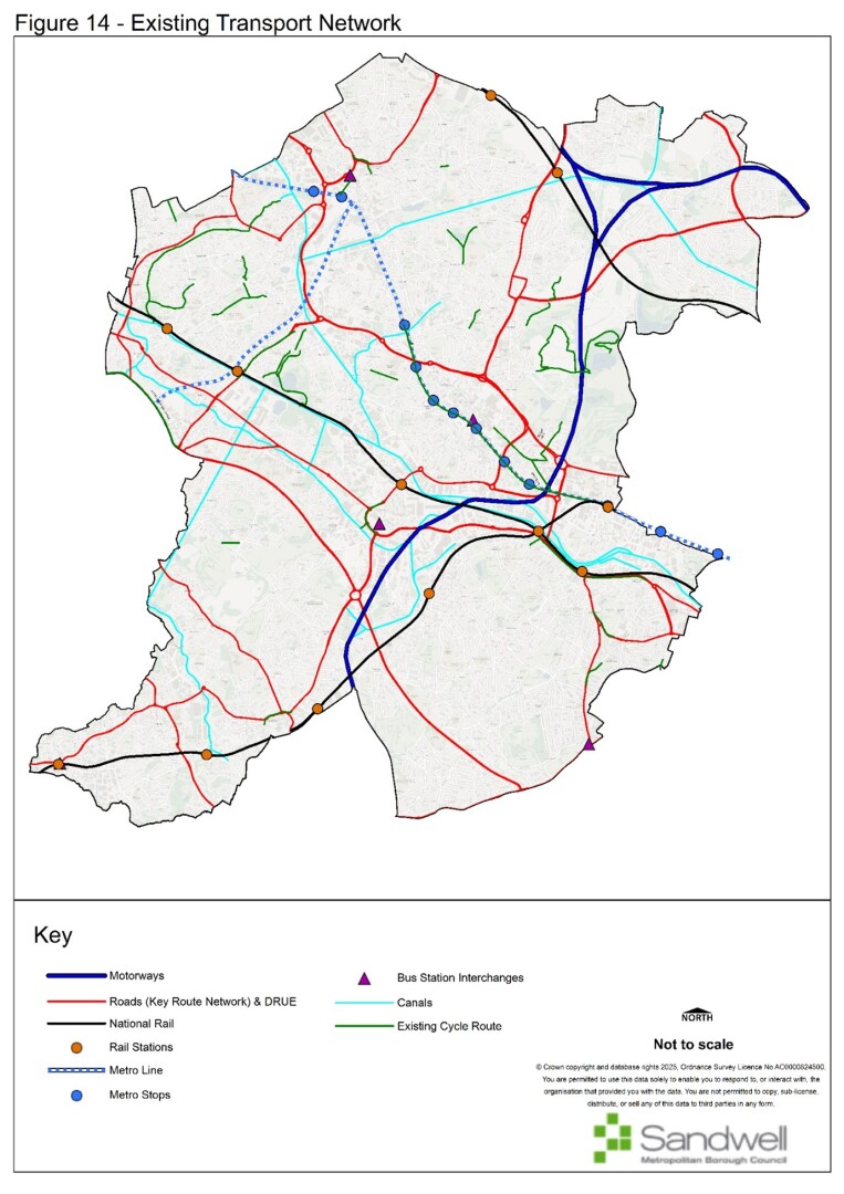
STR1 Figure 14
Proposed change
Amended Figure 14 Existing Transport Network – correct the Key Route Network
Reason
Corrections
MM104
Page / paragraph / policy reference
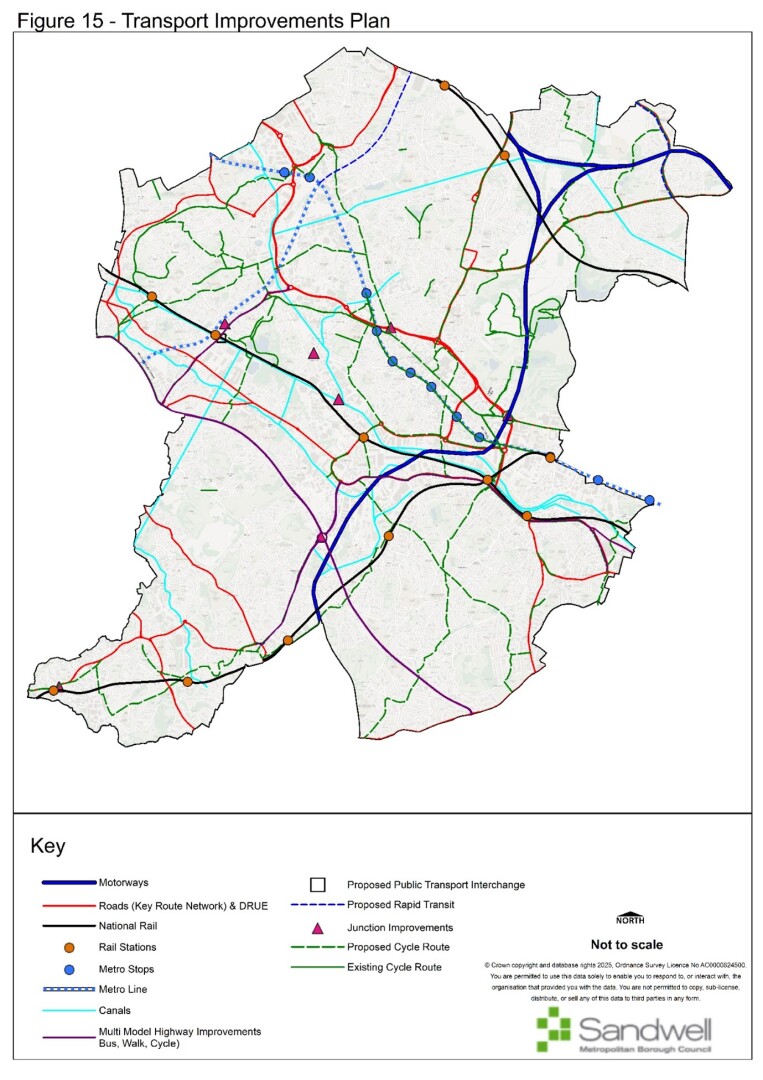
STR1 Figure 15
Proposed change
Amend Figure 15 Transport Improvements Plan – correct the Key Route Network
Reason
Corrections
MM53/ MM105
Page / paragraph / policy reference
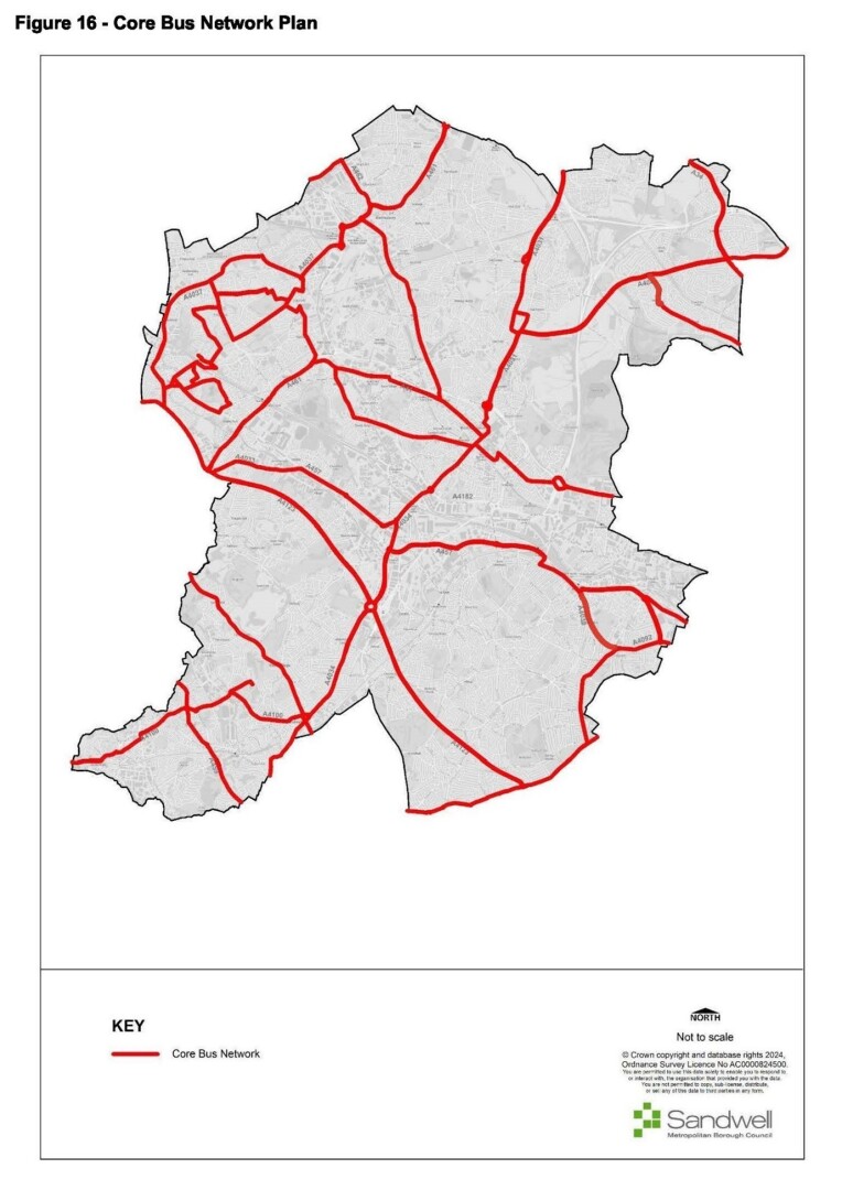
STR1 Figure 16
Proposed change
Amend Figure 16 – Core Bus Network Plan – correct the Core Bus Network
- The plan is missing the current cross-city route from Smethwick (near Rolfe Street Railway Station), through Cape Hill, towards Birmingham (serving buses 54, 82 and 87) and this should be added to the plan.
- The plan shows a route along the A457 Tollhouse Way / Soho Way and then along the B4135 Cranford Street / Heath Street; however, there are no bus services along this route, which should be amended.
The route along Hamstead Road should continue up to the A4041 Newton Road Core Bus Network - replace map with amended version
Reason
Corrections
For instructions on how to use the system and make comments, please see our help guide.